
DRONE FARMING SERVICES
Drone Services for Avocado Orchards - Spraying, Mapping, and Verification
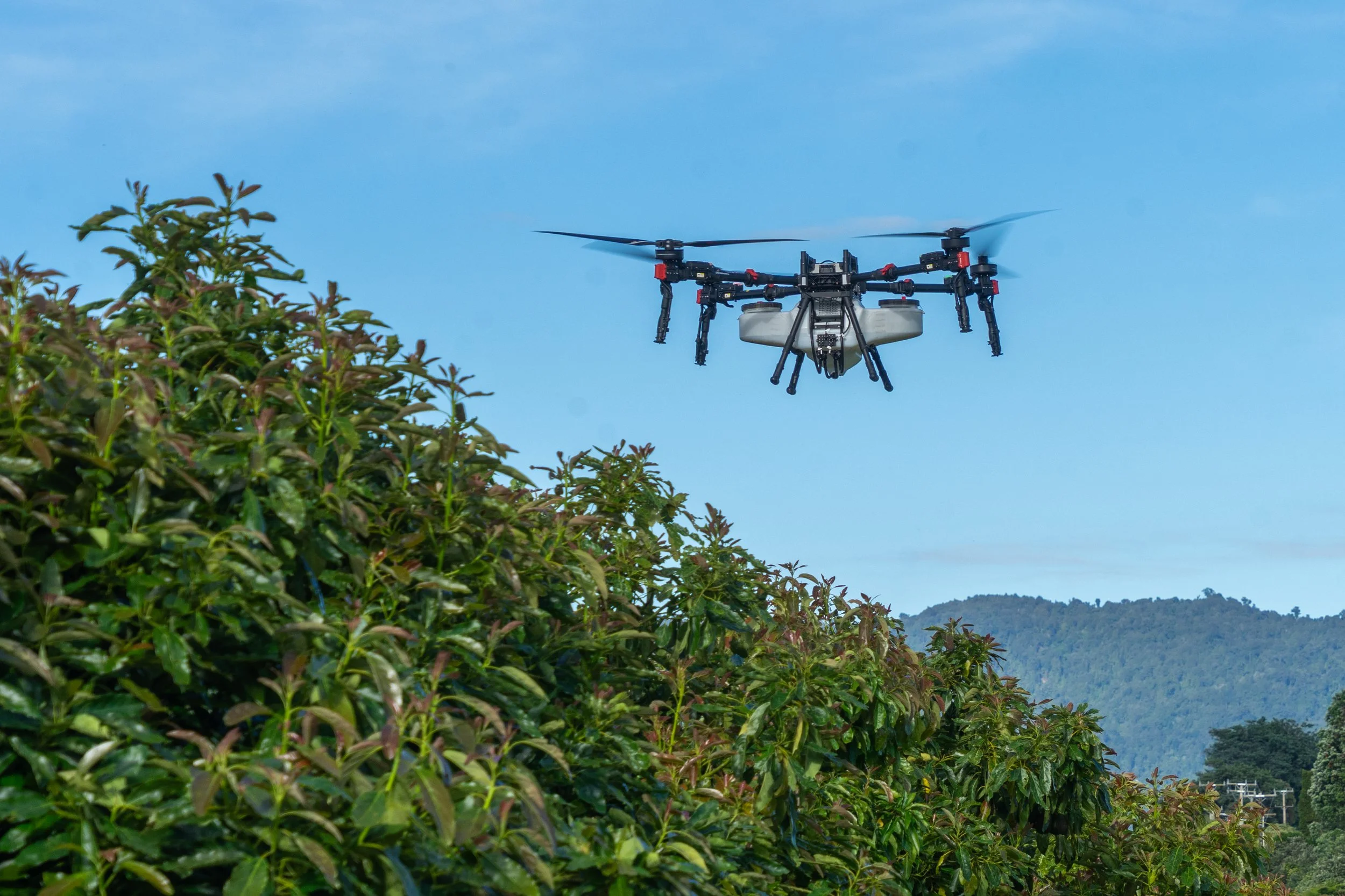
Avocado orchards are one of the clearest use cases for drone application in New Zealand horticulture. Mature blocks become progressively harder to access on the ground as canopies close and crop loads increase - and once a block is canopy-locked, the choice is aerial application or letting pest and disease management slide. We work in avocado orchards regularly, providing spraying, mapping, and verification services across blocks of all types and sizes.
01 / 10
Fungicide & Insecticide Spraying
The access problem is real. A mature avocado block with a full canopy and crop on the trees physically can't be entered with a tractor without breaking branches, knocking fruit, and damaging the trees. The drone flies above the canopy and sprays down through it. If you have a block where ground access has become difficult or impossible, let's talk before you lose a season's crop to unmanaged disease or pest pressure.
01
02
03
Fungicide Application
Avocados are susceptible to a range of fungal diseases, including Phytophthora root rot and various foliar pathogens. We apply registered fungicides accurately across the canopy — including on mature, canopy-locked blocks where a tractor can't travel without causing damage.
Insecticide Application
Pest pressure in avocado orchards needs to stay under control to protect fruit quality and yield. We apply insecticides across the block with good canopy penetration, managing pest populations without the crop damage that comes from forcing ground equipment through a closed canopy.
Ongoing Spray Programme Management
Most avocado orchards require regular fungicide and insecticide applications through the season. We can work on a programme basis - planning applications in advance, booking around weather and crop stage, and completing them reliably.
02 / 10
Canopy Size and Height Mapping
Avocado trees grow fast and canopies expand quickly. Without a clear spatial picture of canopy size and height across the orchard, it's hard to know where pruning work is most needed - or to measure objectively whether work that's been done has made a difference. We map canopy dimensions across the block accurately from the air.
01
02
03
04
Canopy Size Mapping
We map the horizontal extent of each tree's canopy across the block, showing where trees are encroaching on row access, where canopies have merged, and where the orchard structure is becoming difficult to manage. Delivered as a georeferenced map showing canopy coverage across the whole block.
Canopy Height Mapping
Using drone-based sensing, we map canopy height across the orchard - identifying the tallest trees, the areas where height is becoming a management issue, and how consistent height is across the block.
Pruning Priority Identification
The canopy map gives you a spatial picture of where pruning work is most needed. Highest priority areas are clearly visible, so you can plan contractor work efficiently rather than walking every row before making decisions.
Before & After Canopy Measurement
Flying before and after a pruning programme gives you an objective measurement of what was achieved - in cubic metres of canopy removed, height reduction, and row access improvement. Useful for managing contractors, tracking programme progress, and reporting to block owners or management.
03 / 10
Pruning Verification
Verifying that pruning work was completed properly - and that it actually achieved what it was supposed to is often harder than it should be. A before-and-after drone survey takes the ambiguity out of it. You can see exactly what changed, measure it in cubic metres of canopy removed, and have an objective record that's far more useful than a visual walk-through.
WHY A DRONE · Without objective measurement, assessing whether pruning achieved the desired result relies on walking rows and making subjective judgements. A before-and-after map gives you numbers.
01
02
03
Pre-Pruning Survey
Before contractors go in, we fly the block and produce a baseline canopy map - documented starting point for canopy size, height, and structure that the post-pruning survey will be compared against.
Post-Pruning Verification Survey
Once pruning is completed, we fly again and produce an updated canopy map. The comparison shows exactly where work was done, how much canopy was removed, and how the orchard structure has changed. Areas where work was incomplete or inconsistent show up in the comparison.
Volume & Area Calculations
From the before-and-after maps, we calculate how much canopy was removed — in volume (cubic metres) and canopy area. A clear, objective basis for assessing the work and, where relevant, verifying contractor payments.
02 / 10
Bay & Row Measurement
Most orchards have a general map that gives an overall block area, but few have accurate measurements at the individual row or bay level. When you're paying pruners, pickers, or other contractors by area, or tracking inputs and outputs at a fine spatial scale, that general-level data isn't enough.
WHY A DRONE · If you're paying pruners, pickers, or thinners by area, knowing the actual area of each row or bay means you're not estimating or arguing about figures. Row and bay measurement is typically done once and then used for years.
01
02
Individual Bay & Row Area Measurement
We fly the orchard and accurately measure the area of each bay and row across the block — giving you precise figures at the level you actually need for contractor management and record-keeping.
Numbering & Spatial Reference
We assign consistent numbering to bays and rows and produce a map showing those references spatially. When everyone — managers, contractors, pickers, agronomists — is working from the same spatial reference, communication and record-keeping become significantly more straightforward.
Tell us about your block
Send us your crop, the job, and roughly where you are. We’ll come and give it a look and tell you straight whether a drone’s the right tool
PREFER TO TALK? CALL JOHN DIRECT